Snow, canyons, and hoodoos (week 7)
|
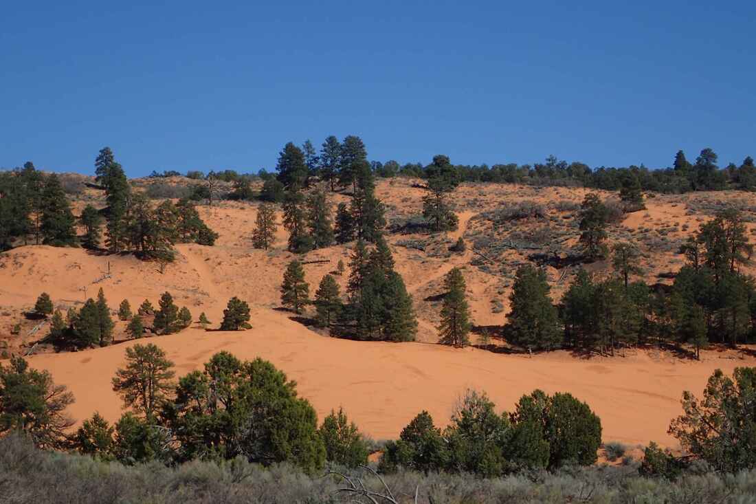
The Coral Pink Sand Dunes were really more of a light peach, and littered with crisscrossing ATV tracks. After the Mesquite dunes in Death Valley, these appeared less impressive. Still, they were different, created by erosion between high plateau walls at over 6000 feet in elevation. The pine trees contrasted nicely with the sand. We also surprised a fancy looking beetle laying its eggs in the sand (too bad about the ATVs…) :(
|
We were going to try our luck at getting in to see the Wave, a famous rock formation in nearby Vermillion Cliffs. To protect the fragile area, the park only admits 20 people per day; 10 from an advanced online lottery, for which there are upwards of 2000 applicants per day, and 10 for an in person lottery, for which there are typically 50 to 200 applicants per day. All in all our odds were low, but it was worth a shot! We didn't get it on our first try.
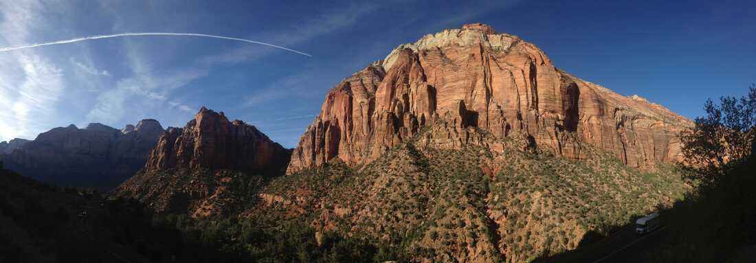
Monday would be rainy, but we thought why not go to Zion National Park anyway since it's pretty close by. It was magnificent in the rain, clouds catching on the gigantic cliffs and mist rising from the forests. Its original Paiute name was Mukuntuweap ("red rock standing in holes"), and the Virgin River, the same river we camped on in Arizona, carves through it. We chose a hike to some pools and waterfalls, figuring they'd have a greater flow in the rain (we were right). The path was treacherously muddy, running alongside steep drops most of the way, and packed full of people despite the cold and rain. Then: snow. A good blanket of snow. It was pretty on the red rocks but still too soon since leaving winter for us to appreciate it fully.
Monday would be rainy, but we thought why not go to Zion National Park anyway since it's pretty close by. It was magnificent in the rain, clouds catching on the gigantic cliffs and mist rising from the forests. Its original Paiute name was Mukuntuweap ("red rock standing in holes"), and the Virgin River, the same river we camped on in Arizona, carves through it. We chose a hike to some pools and waterfalls, figuring they'd have a greater flow in the rain (we were right). The path was treacherously muddy, running alongside steep drops most of the way, and packed full of people despite the cold and rain. Then: snow. A good blanket of snow. It was pretty on the red rocks but still too soon since leaving winter for us to appreciate it fully.
The next day, after our second unsuccessful try at the Wave lottery, we picked out a campsite in the still snowy forest then returned to Mukuntuweap to see it in the sun; the colours were more accentuated but there were less waterfalls. We lunched on a rise across from a herd of female bighorn sheep, and put up with the overcrowded park to go on an overcrowded hike. We really enjoyed all its awesome sights in both weather conditions and despite all the people.
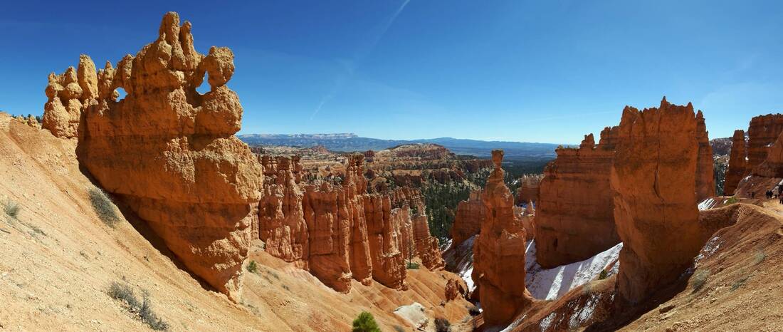
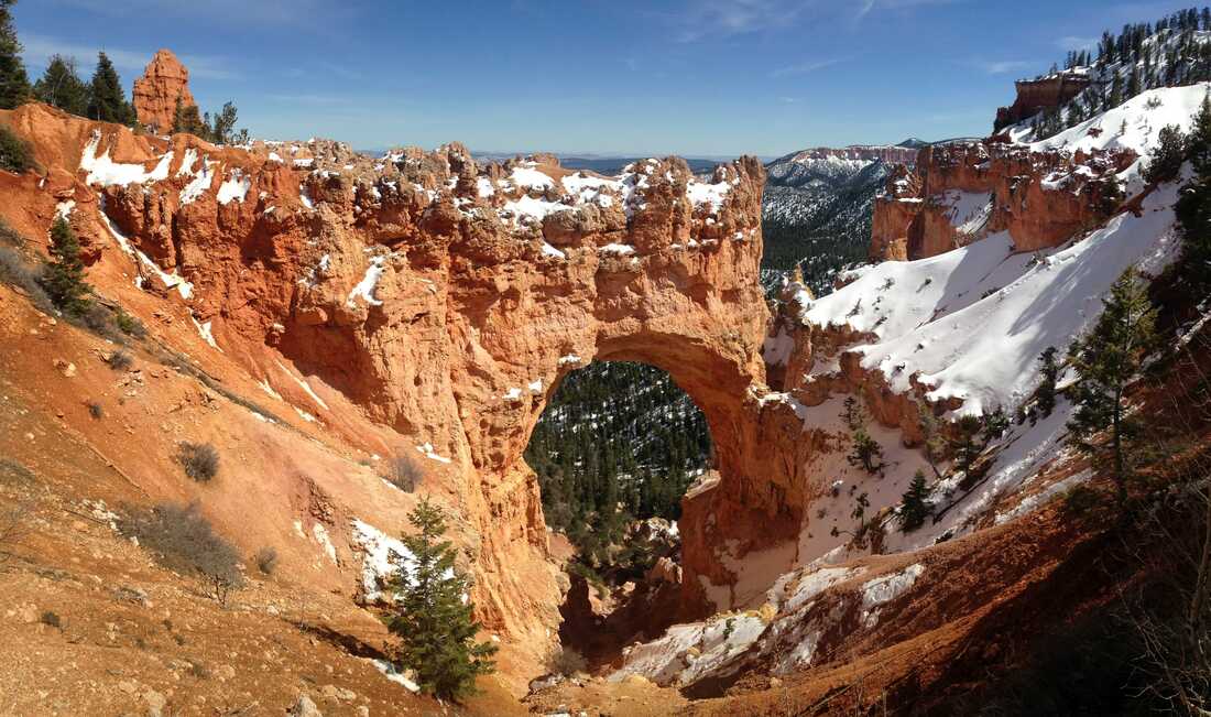
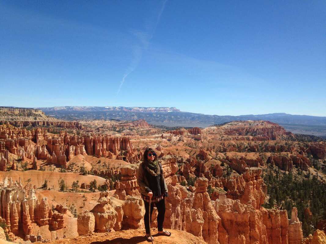
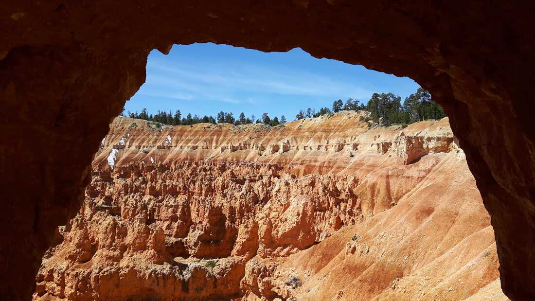
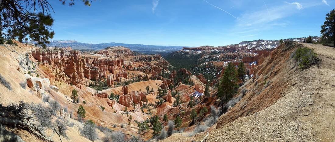
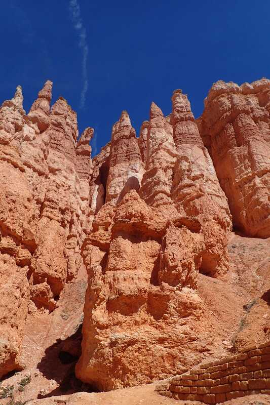
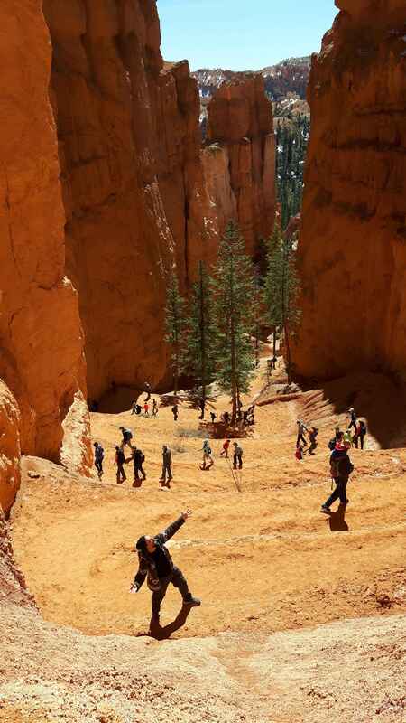
Then, after our third unsuccessful try at the Wave lottery, we drove up to Bryce Canyon. The most impressive section of the canyon is called the amphitheater, a sloped semi-circle with striated rock spires and hoodoos. It was also packed, and finding a parking spot to go on the hike was a bit challenging. We drove out to the southernmost point of the park to admire the view of the canyon from 9115 feet before heading back to our campsite. After the previous night at -5, our second night camping in Ponderosa Grove felt almost warm at -1!
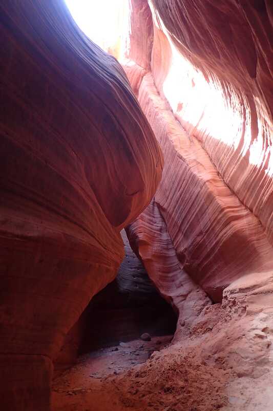
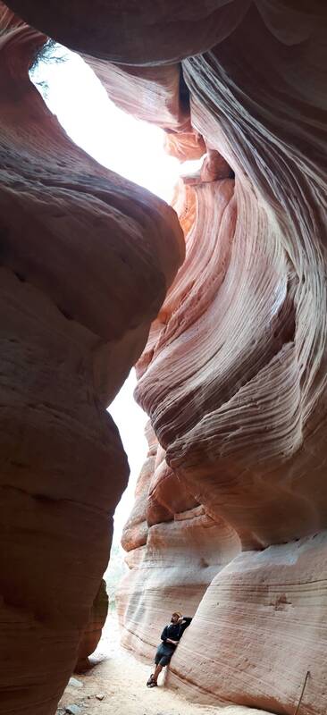
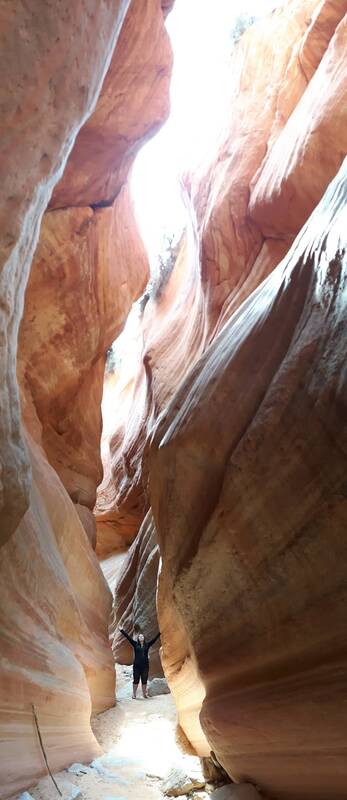
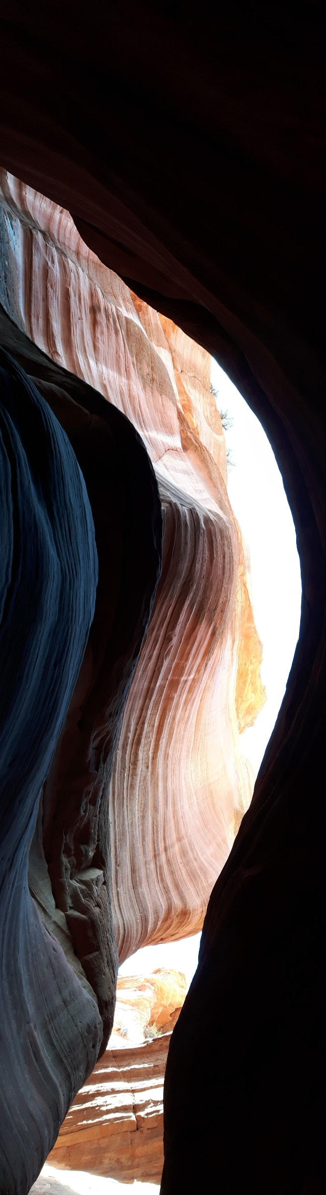
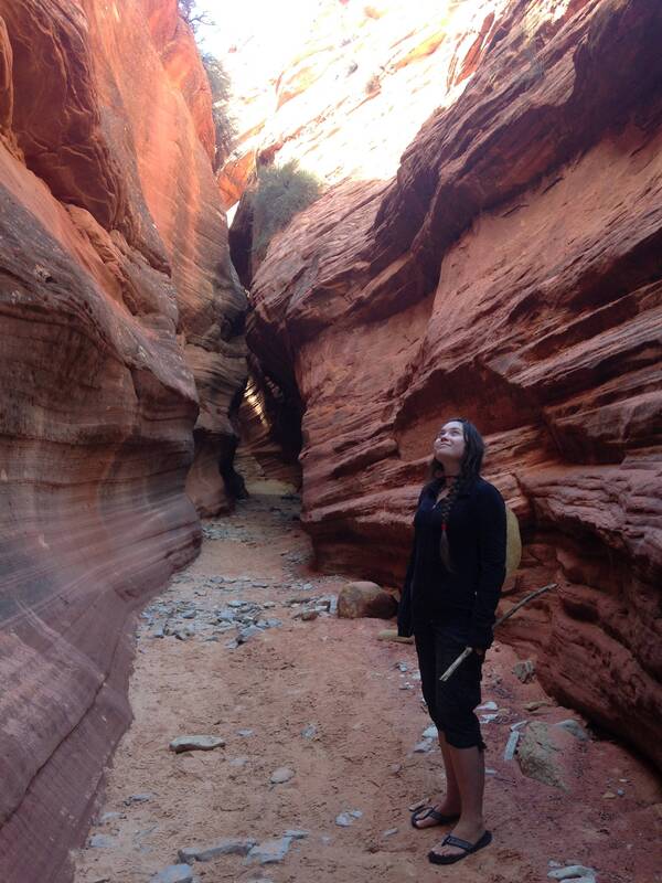
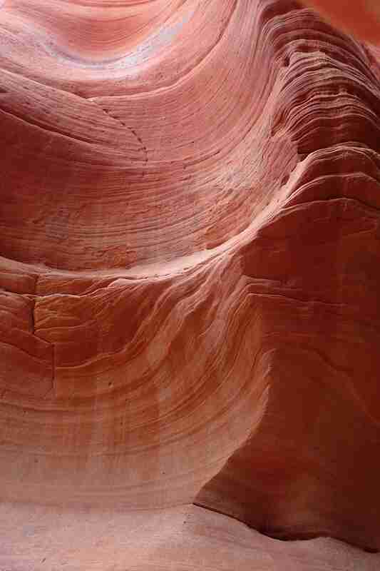
Yet another unsuccessful try at the Wave lottery lead us instead to a nearby trail to Peekaboo canyon. Unfortunately, the road up to the canyon was for ATVs, which added almost 6 miles to our hike. It seemed pretty flat, which is better for my knee, so we went for it. We were so happy we did! The slot canyon was breathtaking, and much longer than we'd thought. A bonus: we were alone practically the whole time. We slowly meandered down the canyon, marveling at the colours and twists and bends in the rock. Gradually, the canyon walls got taller and narrower. We turned a bend, and saw a log stuck diagonally between the walls; at the next bend, the temperature dropped a few degrees. A few more steps, and the wind got cold, then colder still. We looked up and saw logs stuck in the canyon ten, twenty feet above our heads. Another bend, and a trickle of water was coming down the canyon wall, moss growing all around it. We knew there was virtually no risk of a flash flood that day, but we still picked up the pace and jogged the rest of the way. The walls stretched higher and higher as we went; we could see our breath. It was definitely getting close to freezing. Then we finally reached the end, and quickly turned back to warm up in the sun!
We cut through the wilderness on our way back; the terrain was manageable, we had our gps, and we could not have missed the highway even if we overshot the parking lot. Walking through sand and stepping around all the dry bunches of grass, small juniper trees, and prickly pear cactus, we very slowly made our way back, calling out all of the tracks we saw along the way: deer, coyote, deer, deer, deer, beetle, coyote, fox, deer, lizard, coyote, deer...
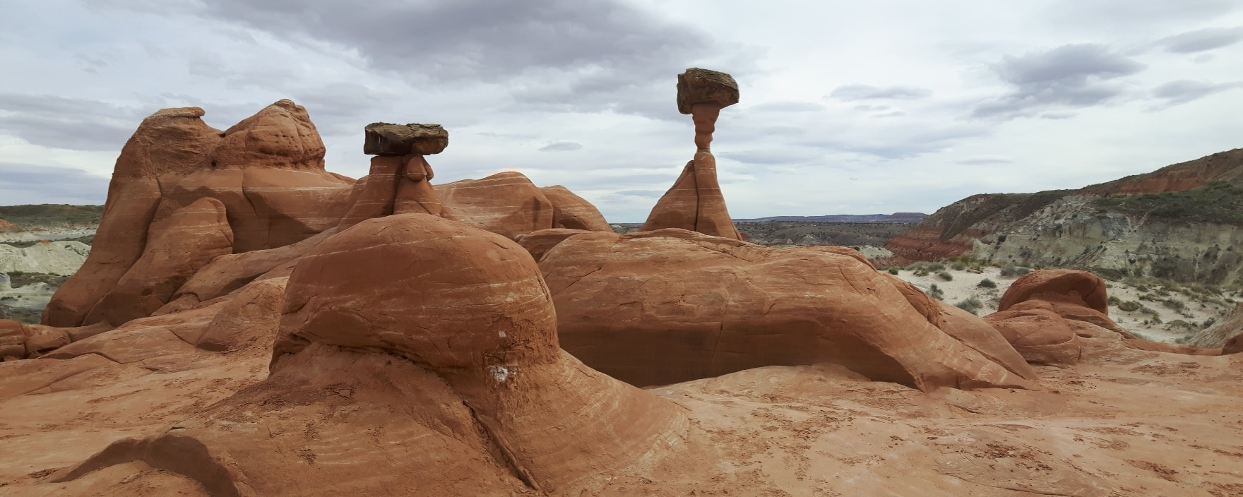
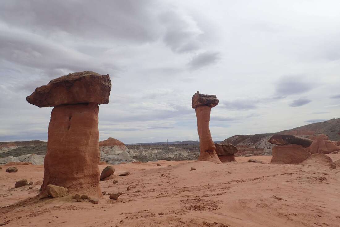
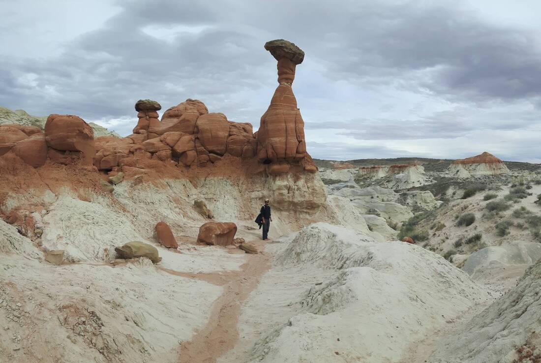
Our fifth and final attempt at the Wave lottery was still a no-go, so we moved on to the next area down the way: Glen Canyon and Lake Powell, stopping at the Toadstool trail on the way to see more weird hoodoos.
Our fifth and final attempt at the Wave lottery was still a no-go, so we moved on to the next area down the way: Glen Canyon and Lake Powell, stopping at the Toadstool trail on the way to see more weird hoodoos.
|
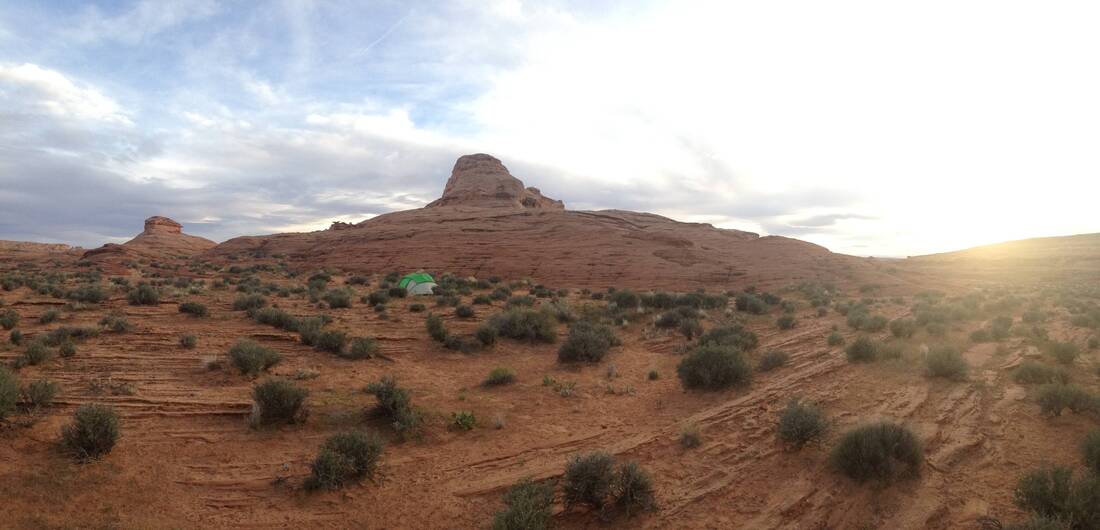
We were both a little disappointed with the immediate Lake Powell area; camping options were expensive and drab, there was really almost nothing to do without a boat or booking an expensive tour, and our eyes were constantly drawn back to three giant smoking chimneys of some poorly placed factory. Luckily, we spotted two parked RVs just outside of Page, and found a nice, if very windy, free camping spot for a couple of nights.
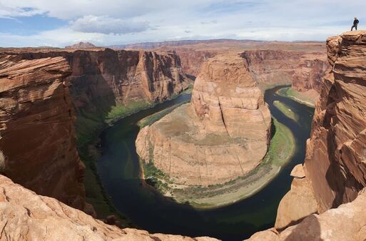
We drove down to horseshoe bend, the prettiest accessible viewpoint of Glen Canyon, but were too tired of big crowds to make the five hour detour back down to the south rim of the Grand Canyon. We've both seen it from a plane which was still quite an impressive view. |
|